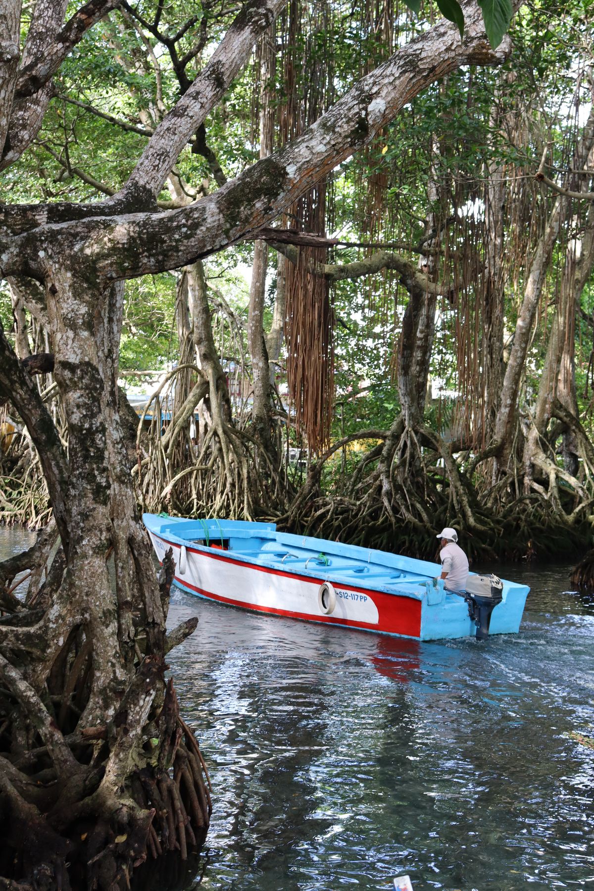
Anyone taking the boat ride through the mangrove tunnels of the Gri-Grí Lagoon often assumes it has always looked just as it does today. In reality, its story is that of a small underground watercourse which, over time, surfaced and grew into one of the best-known lagoons in the Dominican Republic.
The name: the gri-grí tree
The lagoon's name has nothing to do with water, but with a tree: the gri-grí (scientific name Bucida buceras, also known as black olive or júcaro negro). It's a sturdy, long-lived tree that can grow past 15 meters tall, very common in the vegetation lining the lagoon's shores, and the source of the name for both the lagoon and the village of Río San Juan.
What was there before: the karst springs of the Cordillera Septentrional
The lagoon originates from a system of karst springs that rise in the northern foothills of the Cordillera Septentrional, the mountain range running parallel to the north coast. In a karst landscape like this one, rainwater seeps into the limestone bedrock, slowly dissolves it over the centuries and carves out underground passages — the very same mechanism that, not far away, also gave rise to the natural cenote of Laguna Dudú. That water filters underground toward the coast, until it resurfaces close to the sea.
According to local tradition, before becoming the lagoon we know today, this underground water only fed a modest stream on the surface: a small watercourse, not a body of standing water. The story goes that it was the great earthquake of August 4, 1946 — magnitude 8.0, with an epicenter just off Samaná, right by the province of María Trinidad Sánchez — that diverted and forced the area's underground water flows up more forcefully, turning that stream into the wider inlet we now call the Gri-Grí Lagoon. It is the strongest earthquake ever recorded in Dominican history, strong enough to trigger a violent tsunami on the nearby Bahía Escocesa as well. The direct link to the lagoon's formation remains a story passed down rather than a documented geological fact, but it's consistent both with the sheer scale of the event and with the karst nature of the terrain: an underground water system that already existed, diverted and made visible by a tremor of that magnitude.
At a glance
- Origin: karst springs of the Cordillera Septentrional
- Before the lagoon: a stream fed by the same underground aquifer, according to local tradition diverted and widened by the magnitude 8.0 earthquake of August 4, 1946
- Water type: brackish (freshwater spring + tidal seawater)
- Protected area: Natural Monument since 2009 (Decree 571-09), 16.15 km² of land and sea
How it's fed today: freshwater, tide and brackish water
Today the Gri-Grí Lagoon receives water from two sources that meet. On one side, karst springs continue to supply it with freshwater from underground. On the other, a natural channel about 260 meters long connects it directly to the Atlantic Ocean: at high tide, seawater flows up this channel and mixes with the freshwater from the springs. The result is brackish water — neither fully fresh nor fully salt — that shifts slightly in salinity depending on the tide. It's precisely this double feed, fresh and marine, that makes the lagoon an ideal environment for the mangroves and the wildlife that lives there.
A mangrove ecosystem
The lagoon's shores are dominated by red mangrove (mangle rojo), recognizable by the aerial roots that arch over the water — the very same natural tunnels you pass through by boat during the excursion. Alongside the red mangrove grow button mangrove (mangle botón), royal palm, and of course the gri-grí that gives the place its name. This tangle of roots and brackish water is home to rich wildlife: waterbirds, crabs, shrimp, fish and small reptiles find a natural shelter here, protected from the open sea's wave action.
A protected natural monument
In 2009, under Decree 571-09 issued pursuant to Protected Areas Law 202-04, the Gri-Grí Lagoon was declared a Natural Monument. The protected area spans 16.15 km² of land and sea in the municipality of Río San Juan, María Trinidad Sánchez province — a designation that safeguards both the mangrove ecosystem and the karst water system that continues to feed it.
Frequently asked questions
Why is it called Gri-Grí Lagoon?
It's named after the gri-grí (Bucida buceras), a sturdy, long-lived tree that can grow up to 15 meters tall and is common in the vegetation around the lagoon.
Is the Gri-Grí Lagoon fresh or salt water?
It's brackish water: it originates from freshwater springs that filter through the karst subsoil, but mixes with seawater through a channel that connects it directly to the Atlantic Ocean, especially at high tide.
Where does the Gri-Grí Lagoon's water come from?
From karst springs that rise in the northern foothills of the Cordillera Septentrional: the water filters through limestone bedrock and resurfaces near the coast, where it meets the sea.
Want to see the Gri-Grí Lagoon up close?
We're happy to arrange the boat ride through the mangroves with a trusted local captain, with a stop at the Swallows' Cave and Playa Caletón.
Message us on WhatsApp